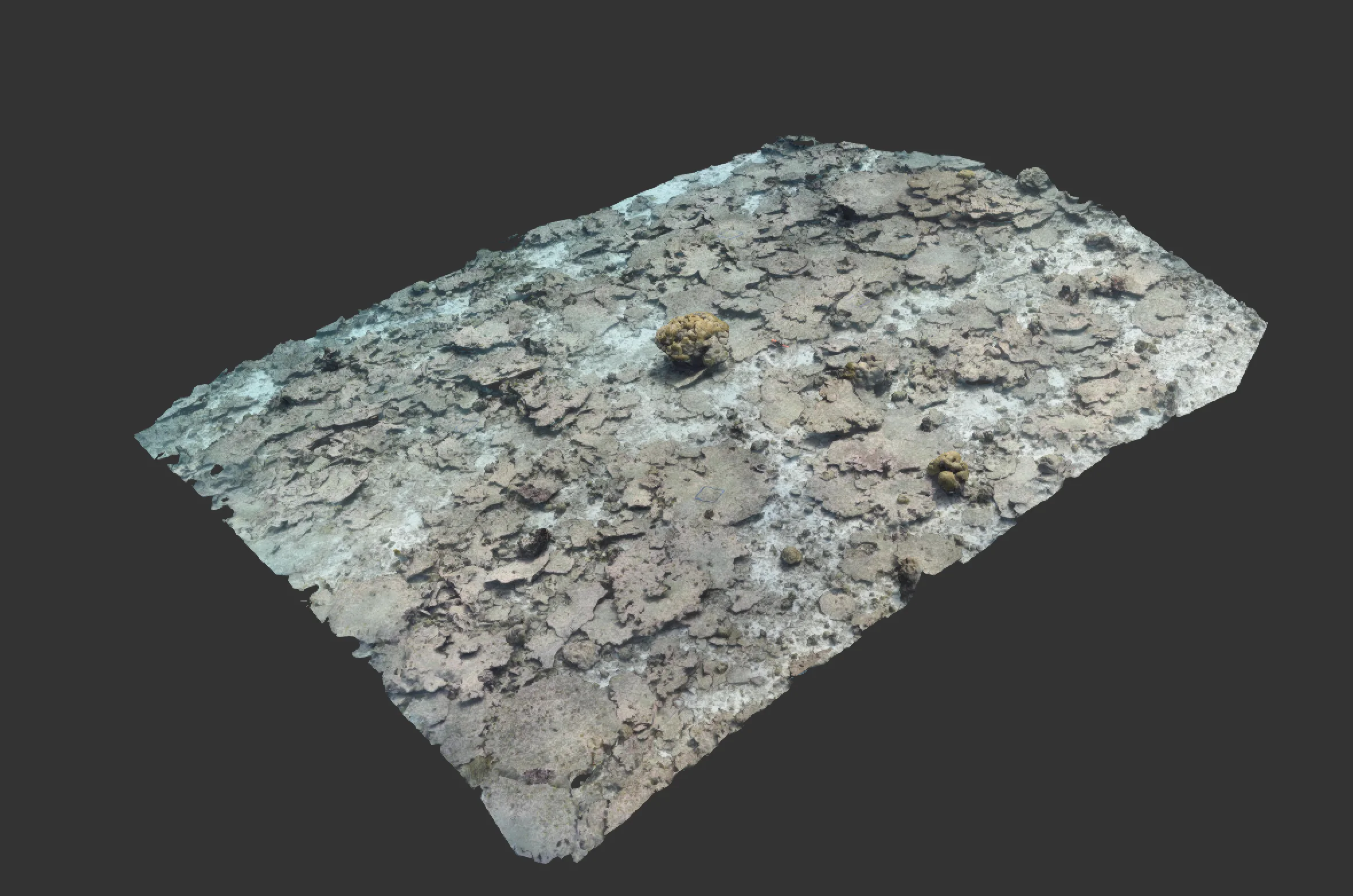
Using 3D photogrammetry to create highly accurate visual computer models
Our models visually expose structures or environments that are not possible to see using traditional methods, producing permanent records that can be continuously assessed and used for whatever the client needs. We make the water disappear virtually, producing clear visibility even in turbid or low-light conditions.
The models generate accurate and dependable data giving confidence for important management decisions and regulatory reporting. Precision and accuracy achieved using:
- High-end through-water GPS systems for georeferencing;
- Lasers or delineated markers for scaling and orientation;
- Salinity-corrected pressure sensors for depth measurement.


Accurate and reliable observations of underwater structures and environments are vital for the aquaculture industry
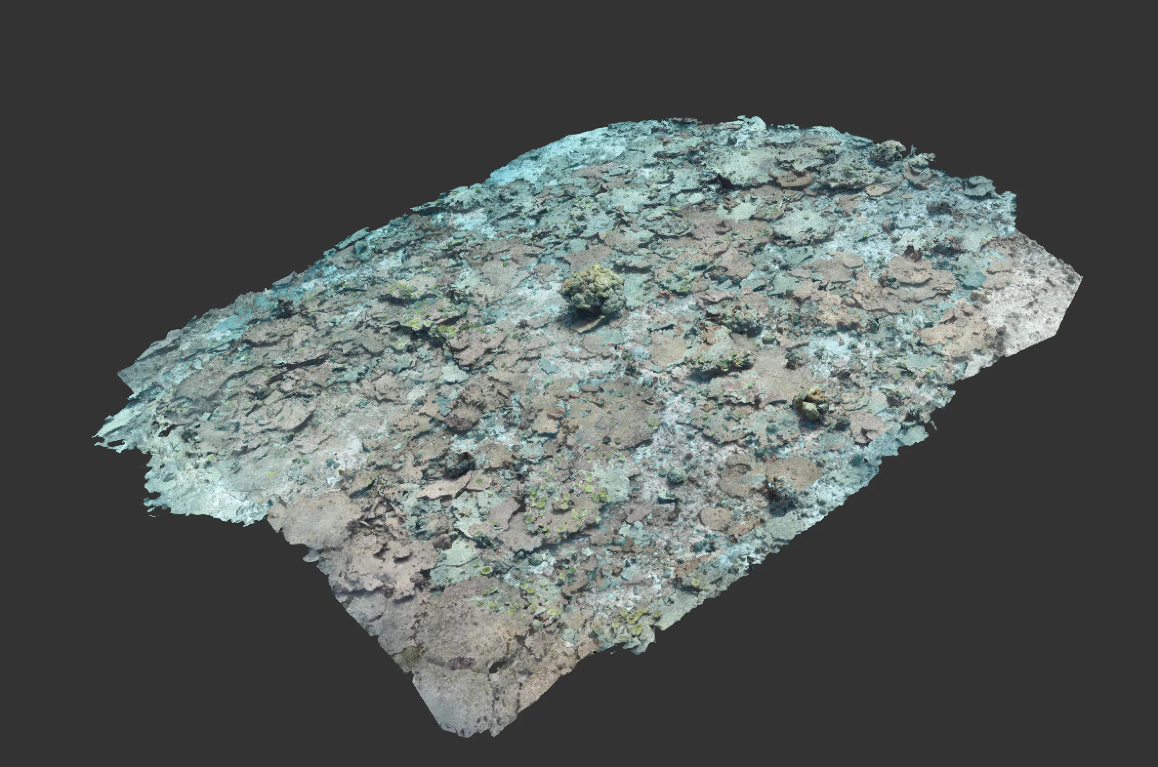
Beyond the initial survey requirements, our clients have found additional advantages of the models, including exact positioning as to where environmental samples, such as seabed cores, are taken or where invasive species have been identified during biosecurity surveys.
Precise changes can be identified using comparison software on subsequent models which means that fewer surveys are needed to show what is happening over time.
Enhanced Intertidal Surveying: Precision Mapping for Aquaculture
Intertidal surveys employ advanced 3D photogrammetry services using low-tide aerial drone surveys. These capture detailed imagery, creating precise photogrammetric maps for intertidal aquaculture zones. The resulting orthomosaic models integrate geographical data with shore elevation details, offering a comprehensive view.
This detailed insight aids in managing intertidal aquaculture sites with greater accuracy and informed decision-making within the aquaculture sector.
Empowering Aquaculture Sustainability: Innovating Through Biosecurity Surveys
Our commitment to revolutionising aquaculture sustainability extends to our specialised biosecurity surveys. In collaboration with industry experts, we provide tailored guidance for developing site-specific biosecurity plans crucial for protecting marine ecosystems. These plans are essential in preventing the introduction and proliferation of non-native species, mitigating potential threats to biodiversity and the aquaculture sector.
Our comprehensive approach addresses the critical need for biosecurity measures within aquaculture businesses. By leveraging advanced surveying techniques and expert knowledge, we equip industry stakeholders with the tools to proactively protect their operations and contribute to the longevity of the marine environment.
Underwater Infrastructure Evaluation and Mapping Solutions
Our consultancy extends comprehensive services in evaluating and mapping underwater infrastructure, leveraging cutting-edge 3D photogrammetry and diving expertise. Through meticulous underwater surveys, we assess the condition of aquaculture infrastructure—nets, cages, and support structures—providing detailed mapping of their layouts and structural integrity.
This combined approach not only offers an in-depth analysis of infrastructure conditions but also provides precise bathymetric mapping. These detailed underwater topographic maps aid in site selection, planning, and understanding the underwater terrain for efficient and strategic deployment of aquaculture installations. Our integrated services ensure that aquaculture businesses can maintain, repair, or plan their infrastructure with accuracy and foresight, contributing to operational efficiency and sustainability within the industry.